Displaying information on an interactive map really isn’t that hard to do. My friends John & Bronwen have been doing this stuff for ages through their company Soul Solutions, and have done lots of talks about how to do this. They have the ability to take that stuff far beyond what I can, but as it’s a significant aspect of data visualisation, it’s an area in which I like to be fairly fluent.
I wrote a blog post last month on how to fetch latitude and longitude values for addresses, which I did using PowerShell, but the same technology applies just as easily in any language capable to calling web services (including SSIS, it’s worth noting). I love how simple it is to do this, and being .Net, it’s even very straight forward to make a CLR object that can be called using T-SQL.
So once I have the latitude and longitude, I can easily get that into my database.
For example, if I look up an address in Chicago, I might get Lat/Lng as 41.885889, –87.632323. This is the location of PASS HQ. To use this with the spatial type, I can use something like: select geography::STGeomFromText(‘POINT(-87.632323 41.885889)’,4326). And of course, once I have a database with that information, I can easily write some code which can loop through them, adding pushpin images to a Bing Maps Silverlight control.
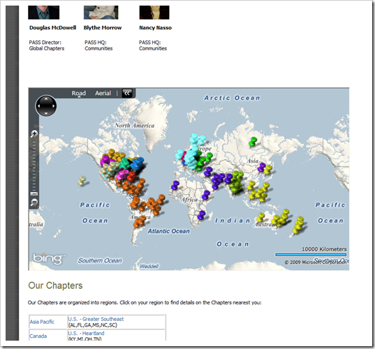
And now, PASS have linked to the map I put together on their site. So if you go to http://www.sqlpass.org/PASSChapters.aspx, you can more easily find a chapter location near you (or wherever you want to go).
This map (not the screenshot of it above) lets you zoom in, switch to aerial, everything you’d expect from a Bing Map, and if you mouse-over the pushpin, you can see some more information about the particular chapter. If you’re a chapter leader, and want to get some information updated, I’m sure you can get that information to me somehow…

This Post Has One Comment
Wow, looks like we need some folks in the mid west to get some PASS love going on!